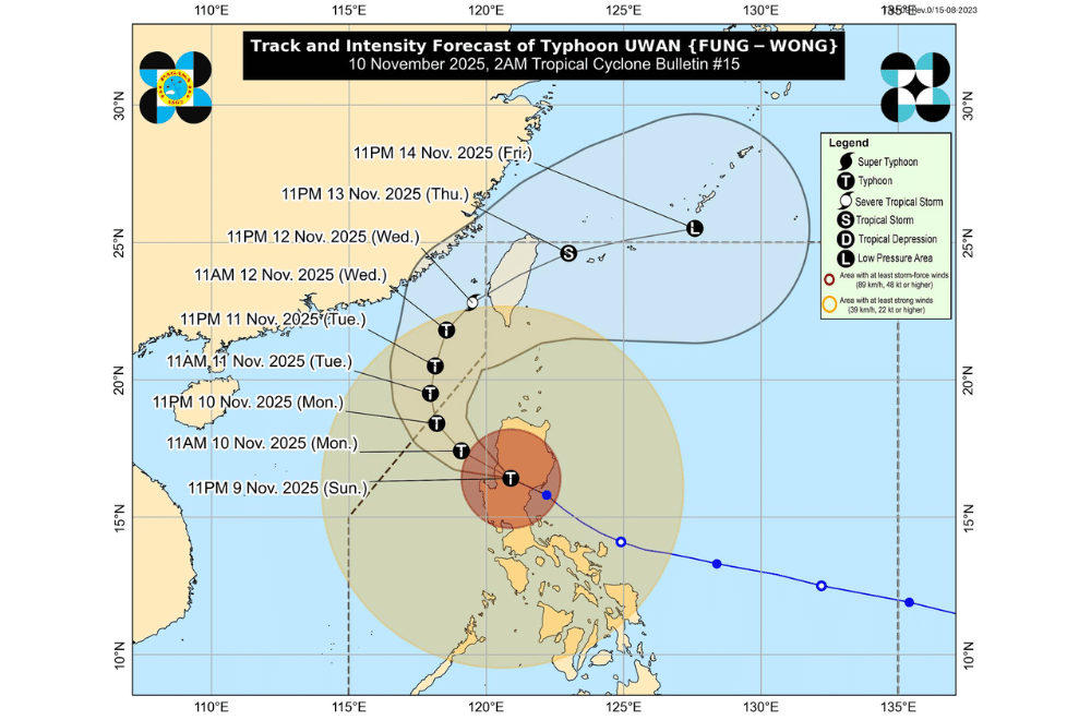
#UwanPH weakened slightly and downgraded into a typhoon after crossing Northern Luzon early Monday, November 10, 2025, but continued to bring strong winds, heavy rains, and rough seas across most of the country, according to PAGASA.
At 1 a.m., the eye of Uwan was located over Bagulin, La Union, packing maximum sustained winds of 165 kilometers per hour (km/h) near the center, gusts of up to 275 km/h, and moving northwest at 30 km/h. The typhoon’s winds extend up to 780 kilometers from its center.
Uwan is expected to move northwest and reemerge over the West Philippine Sea this morning, maintaining its typhoon strength until Tuesday. It will then gradually weaken as it moves northward toward the Taiwan Strait by midweek.
PAGASA said Uwan could make landfall in western Taiwan by Thursday, November 13, before weakening into a low-pressure area as it exits toward the Ryukyu Islands.
AREAS UNDER TROPICAL CYCLONE WIND SIGNALS
Areas under Wind Signal No.
Continue Reading on GMA News
This preview shows approximately 15% of the article. Read the full story on the publisher's website to support quality journalism.