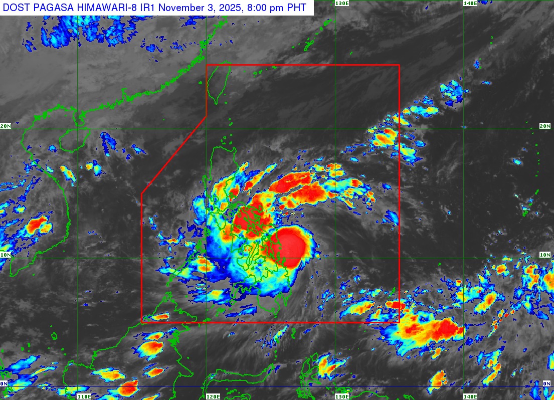
Typhoon Tino intensifies further while moving west northwestward over the east of Dinagat Islands, according to PAGASA weather bulletin issued at 8 p.m. on Monday, November 3, 2025.
• Location of Center (7 p.m.)
The center of the eye of #TinoPH was estimated based on all available data including those from Guiuan Doppler Weather Radar at 95 km Southeast of Guiuan, Eastern Samar (10.5°N, 126.4°E).
• Intensity
Maximum sustained winds of 140 km/h near the center, gustiness of up to 170 km/h, and central pressure of 965 hPa
• Present Movement
West northwestward at 15 km/h
• Extent of Tropical Cyclone Winds
Strong to typhoon-force winds extend outwards up to 300 km from the center
TROPICAL CYCLONE WIND SIGNALS (TCWS) IN EFFECT
TCWS No. 4
* Wind threat: Typhoon-force winds
* Warning lead time: 12 hours
* Range of wind speeds: 118 to 184 km/h (Beaufort 12)
* Potential impacts of winds: Significant to severe threat to life and property
VISAYAS:
The extreme southeastern
Continue Reading on GMA News
This preview shows approximately 15% of the article. Read the full story on the publisher's website to support quality journalism.